The second training and capacity building session consisted of a two-day field event conducted at the Salutaris Park in Paraiba do Sul. The activities were scheduled coincidently with an intensive training camp organized by the Brazilian southeast firefighting division . The camp included a class of +50 future firefighters and covered specific training on wildfire suppression and mapping techniques. The Brazilian collaborators used this unique opportunity to engage the new class of firefighters on best practices involving the satellite active fire and burned area products and reporting of field observations, helping further disseminate satellite data use in support of fire management applications.
Fabiano Morelli (INPE), Heber Passos (INPE), Filippe Santos (UFRJ), Luiza Cavalcanti (UFRJ) e apoio do 15º Grupamento de Bombeiros Militar - Petrópolis
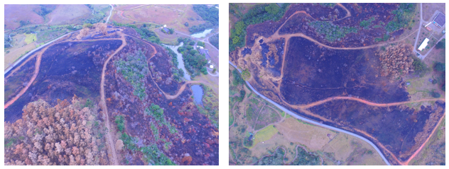
Georeferencing of burned area in the INPE campus.
Heber Passos (INPE), Guilherme Martins (INPE), Marcelo Romão (INPE), Pedro Lagden (INPE)
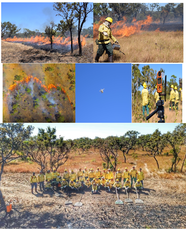
Our activities accompanied the prescribed fire activities of IBAMA/PREVFOGO-TO to test the operation of radiometer and thermal camera coupled to drones to validate the informations from active fire detections by satellites and the meteorological data used in the Fire Risk forecast model at Programa Queimadas (INPE). Therefore, the fire behavior from the main plant functional types in the study area was evaluated by field measurements.
Heber Passos (INPE), Marcelo Romão (INPE), Guilherme Martins (INPE), Joana Nogueira (INPE), brigadistas sob coordenação de Pedro Paulo (IBAMA/PREVFOGO-TO), Marco Giongo (UFT)
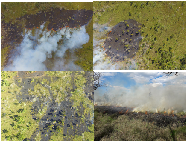
Our activities accompanied the prescribed fire activities of IBAMA/PREVFOGO-MS to test the operation of radiometer and thermal camera coupled to drones to validate the informations from active fire detections by satellites and the meteorological data used in the Fire Risk forecast model at Programa Queimadas (INPE). Therefore, the fire severity and fire behavior from the main plant functional types in the study area was evaluated by field measurements.
Heber Passos (INPE), Marcelo Romão (INPE), Guilherme Martins (INPE), Duarte Oom (ISA), João Silva (ISA), brigadistas sob coordenação de Alexandre Pereira (IBAMA/PREVFOGO-MS)
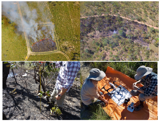
Our activities accompanied the prescribed fire activities of Cerrado Vivo group and the experimental fires from Laboratory of Plant Ecology (LEVeg, UNESP, RioClaro-SP) to test the operation of radiometer and thermal camera coupled to drones to validate the informations from active fire detections by satellites and the meteorological data used in Fire Risk forecast model at Programa Queimadas (INPE). Therefore, the fire behavior from the main plant functional types in the study area was evaluated by field measurements.
Heber Passos (INPE), Joana Nogueira (INPE), Duarte Oom (ISA), João Silva (ISA), brigadistas Grupo Cerrado Vivo, Fundação Grupo Boticário de Proteção à Natureza, members of Laboratory of Plant Ecology (LEVeg, UNESP, RioClaro-SP), coordinated by Alessandra Fidelis (UNESP- Rio Claro)
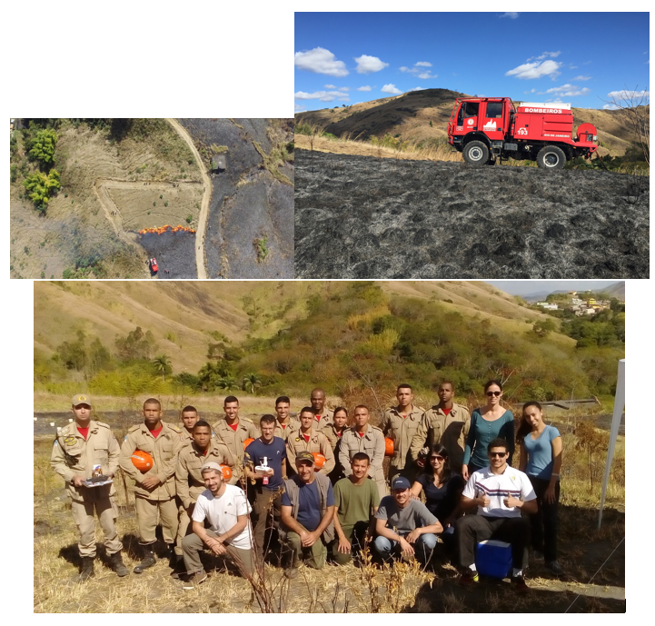
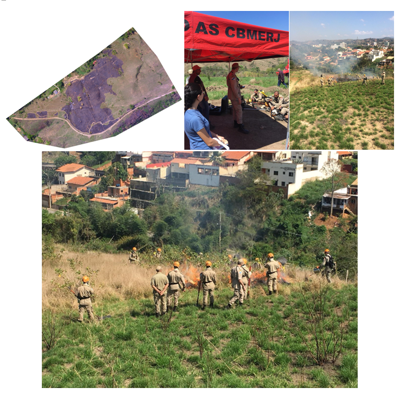
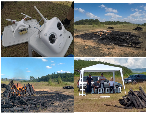
The training and capacity building session consisted of a two-day (12-13 July) field event conducted at the Salutaris Park in Paraiba do Sul. The activities were scheduled coincidently with an intensive training camp organized by the Brazilian southeast firefighting division. The camp included a class of +50 future firefighters and covered specific training on wildfire suppression and mapping techniques. The U.S. and Brazilian collaborators used this unique opportunity to engage the new class of firefighters on best practices involving the satellite active fire and burned area products and reporting of field observations, helping further disseminate satellite data use in support of fire management applications. The event was also attended by the city’s mayor and the executive secretary for the environment who welcomed the partnership between science community and civil society. The training and capacity building activities covered the principles of satellite fire monitoring, qualities and limitations of existing products, as well as the implementation of prescribed burns coincident with satellite overpass schedules. Specialized fire sampling sensors (e.g., infrared cameras, field radiometers) were deployed and successfully demonstrated during six separate burns. Each burn was implemented by a different sub-group of cadets, followed by a debriefing session during which U.S. and Brazilian science collaborators described the existing satellite technology, fire mapping tools and field protocols, and answered questions posted by the group. All activities were supported and coordinated by local civil defense officials.
Renata Libonati (UFRJ), Leonardo Peres (UFRJ), Joana Nogueira (INPE), Heber Passos (INPE), Wilfrid Schroeder (UMD), André Lima (UMD), Filippe Santos (UFRJ), Thaís Ruffo (UFRJ), Fausto Machado (UFRJ) e apoio do 15º Grupamento de Bombeiros Militar - Petrópolis
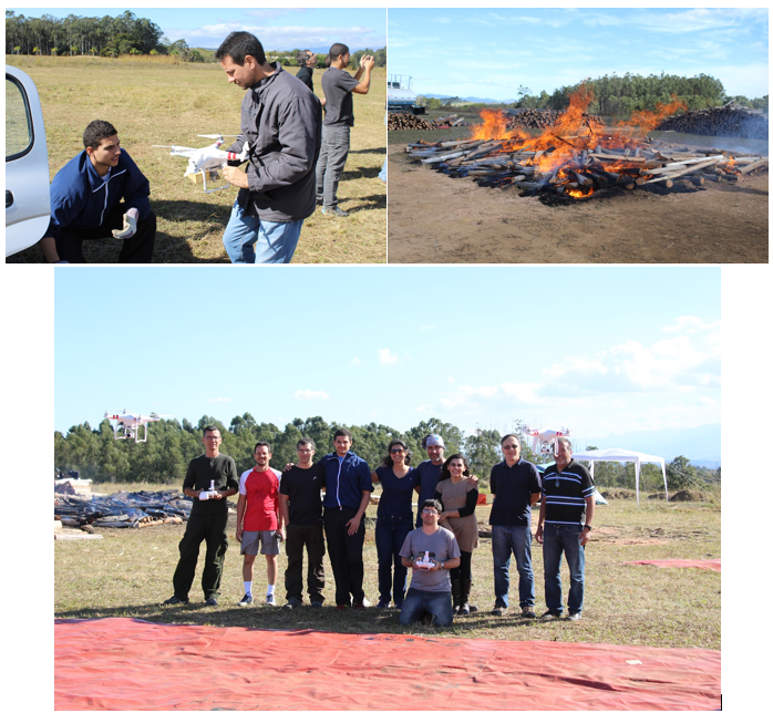
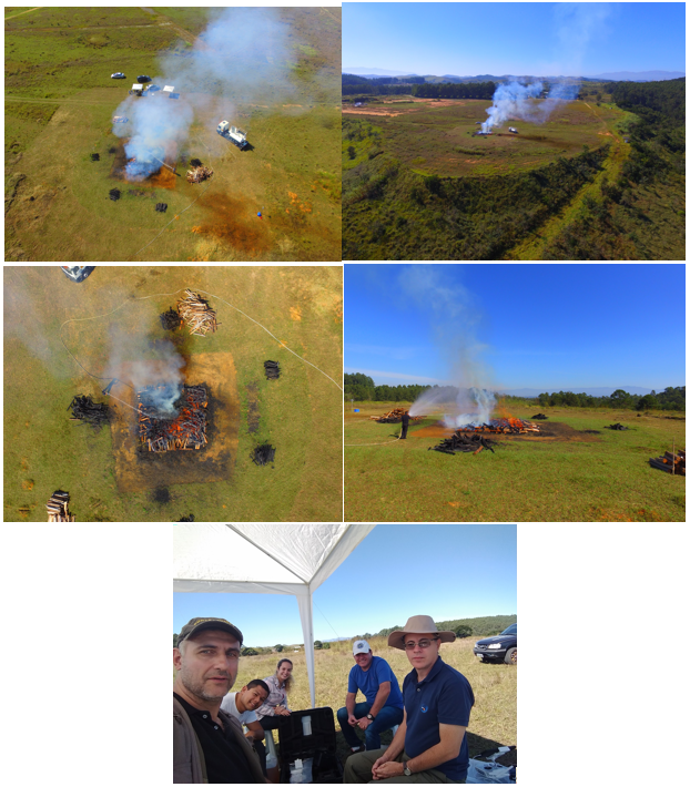
The week-long (3-9 July) field session in Cachoeira Paulista conducted by University of Maryland fire team was used to train INPE’s and UFRJ’s fire monitoring team on satellite fire data field validation protocols and to build regional capacity . Workshop attendees participated in all phases of the field exercise including planning and preparation, pre-burn briefing, burn execution and post-burn debriefing. Planning and preparation phases covered site selection and estimation of burn supplies, plus coordination of logistics. Pre-burn addressed satellite orbit calculations and accurate definition of overpass times, which had to be coordinated with fire ignition, and preparation/configuration of scientific instrumentation. Burn execution involved activation of IINPE’s and UFRJ’s fire crew and deployment of scientific instrumentation, in addition to discussion of optimal fire sampling procedures in response to variable ambient conditions. Post-burn debriefing covered overall fire execution assessment (e.g., effect of fuel and weather conditions on fire behavior) and retrieval of scientific instrument. In total, six consecutive days of burning were successfully accomplished during which workshop attendees were able to participate in various phases of the exercise. Complementing the experimental burns, attendees participated in the configuration and launch of two weather balloons carrying radiosondes for the assessment of atmospheric conditions which are known to influence satellite data quality through the attenuation of fire radiance signals. Field logistics were provided by INPE, including provision of manpower and fire crews required for the site preparation and safety of all participants. In addition to the outdoor training activities, attendees were able to participate in indoor technical discussions during which the UMD and Brazilian collaborators provided status updates on regional and global satellite active fire and burn area mapping products, as well as cutting-edge weather-fire behavior modeling frameworks being used by the U.S. fire management community.
Joana Nogueira (INPE), Heber Passos (INPE), Guilherme Martins (INPE), Marcelo Romão (INPE), Fernanda Batista (INPE)
Campanhas de validação de produtos de focos de calor produzidos via Sensoriamento Remoto através de experimentos de campo com queima prescrita utilizando instrumentos medidores de temperatura e radiação eletromagnética acoplados em drones.
Renata Libonati (UFRJ), Leonardo Peres (UFRJ), Joana Nogueira (INPE), Heber Passos (INPE), Wilfrid Schroeder (UMD), André Lima (UMD), Filippe Santos (UFRJ), Thaís Ruffo (UFRJ), Fausto Machado (UFRJ) e apoio do 15º Grupamento de Bombeiros Militar - Petrópolis
Campanhas de validação de produtos de focos de calor produzidos via Sensoriamento Remoto através de experimentos de campo com queima prescrita utilizando instrumentos medidores de temperatura e radiação eletromagnética acoplados em drones.
Joana Nogueira (INPE), Heber Passos (INPE)
Copyright © 2019 - All Rights Reserved - Instituto Dom Luiz - Faculdade de Ciências da Universidade de Lisboa
Template by OS Templates